Hexacopter takes Sensors to the Skies
Interview with
Also this week, Cambridge University researchers have tested out a new way of monitoring the atmosphere - using sensors mounted on a battery-powered remote-controlled flying vehicle called a Hexacopter.
It resembles a helicopter, except it's got 6 rotors; we sent Ginny Smith along to see the project team - of computer scientists and chemists - putting it through its paces...
Andrew - Three, two, one...
Ginny - And we have take-up.
Andrew - My name is Andrew Rice. I'm a lecturer here in the computer lab. We've just been flying our hexacopter. Really, this is a small part of some of the things that we do where we basically use sensors and computers to try and measure things about the environment. So, with the hexacopter, we were measuring CO2 today, but really, the bigger project is just how much information can we collect about the world, and how can we use that in useful ways to better understand what's going on.
Ginny - Where did the idea for using this hexacopter come from?
Andrew - One of my students was watching YouTube videos of other universities flying hexacopters and we decided that it will be an interesting thing to experiment where there's a measurement platform. So, we've done things before, putting sensors onto bicycles or sensors onto vans. So, this is just another platform for us to attach sensors to. And really, the interesting questions from the computer science people is about the control. It's about how to decide where to fly it, what flight path it should take, and what interface you present actually to the scientist who allow them to run their experiments.
Ginny - And have you had to change it much or did you just buy this 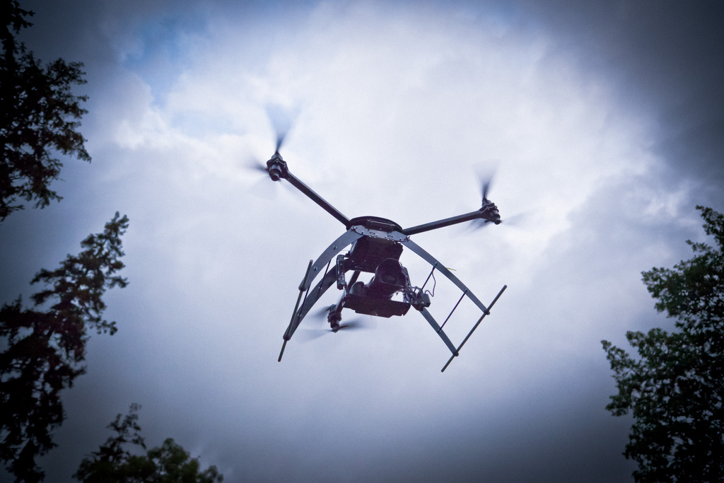 thing off the shelf and fly it?
Andrew - We bought it in kit form and my students put it together. We've just been sort of generally experimenting, getting first of all, some knowledge about flying these things, and then starting to get used to the idea about what sort of interfaces we might need when we actually try to control it. So, at the moment, it's all pretty much off the shelf and we use a standard sort of helicopter remote control that people use for flying model aircraft. But over time, what we will be doing is building more sort of abstract interfaces which the computer can use to fly the device.
Rod - I'm Rod Jones. I'm a Professor in the Department of Chemistry in Cambridge. We're involved in this project which is obviously at its very early stages because we've built over a number of years now, a large number of chemical sensors which are really small, really light, low cost. A lot of the studies we do look at over their quality. Others look at much harsher environments like volcanoes and I could imagine the kind of technologies that we looked at today, working really quite well in both of those kinds of areas.
Ginny - At the moment, how do you gather data about the air quality?
Rod - Well, at the moment, we install networks of sensors really at street level, so we could mount them on posts and something like this. And what that gives you is a snapshot of what's happening at the surface, but at lots of different sites. What this is going to allow us to do, hopefully, is to allow us to extend our knowledge in the vertical, the measurements in the vertical so that we can see how the structure that we know is present at street level for example, would extend upwards in altitude. And once we can do that, we can do a much better job of understanding the exposure of individuals to air pollution and then arguably, and possibly the health effects that are going to accrue as they're exposed to different levels of pollution.
Ginny - So, the hexacopter we were looking at today is an unmanned vehicle. So, you fly it with a remote control. What are the benefits of that compared to say, putting these sensors on a normal airplane or helicopter?
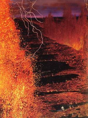 Rod - Well, there are quite a few benefits. There's an obvious one which is the cost. These are an awful lot cheaper than flying a manned aeroplane, but there are more relevant ones in some ways because we can actually take a hexacopter or something like a hexacopter and put it into an environment that we couldn't possibly use a manned aeroplane in either on the grounds of safety in terms of where the aeroplane is flying very close to the ground, or in terms of say, a volcanic eruption where we know that there could be damage caused to the aeroplane by the volcanic plume itself, and we could put something like this through a volcanic plume and there's no personal risk involved. So, it's actually much safer science in a way.
Ginny - And is everything going pretty smoothly so far or have you had any problems with flying it?
Andrew - Well, this is our second one. The first one we were flying and we've just attached the GPS chip to it and we think there was a software bug which caused it to turn itself upside down and fly to the floor. And that caused about 1,000 pounds worth of damage to the hexacopter so we had to buy another one basically. But other than that, there's been no sort of major mishaps. No one has been injured and we always stick to the flight path.
Chris - Andrew Rice from Cambridge University's computer lab and before him, Rod Jones from the Department of Chemistry, and they were speaking with Ginny Smith. And I did actually chat to Andy Rice about that. He told me that the energy consumption, the batteries, they're supplying 60 amps to keep that thing aloft which is quite some discharge where it buys some half an hour of air time. But the batteries alone must be a lot of the price I would think.





Comments
Add a comment